Learn how to plan safe, scenic cycling routes using Google Maps with tips on biking mode, elevation checks, offline maps, and Calgary-specific routes. Avoid car routes and find real bike paths.
Whether you’re heading to work, a weekend ride, or a new trail, knowing how to navigate on a bike makes the difference between a great day and a frustrating one. The good news is you don’t need a fancy system – just a few simple habits and the right tools.
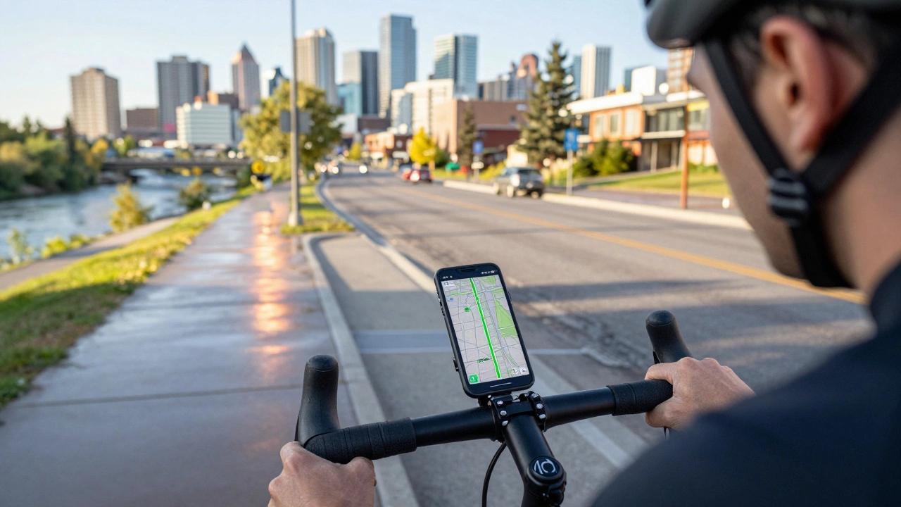
Start with a map app that’s built for cyclists. Google Maps has a cycling layer that shows bike lanes, traffic‑free paths, and elevation. Komoot and Strava Route Builder let you draw your own route, add waypoints, and see how hard the climb will be. Most of these apps work offline, so you won’t lose your way if you drop a signal.
If you prefer a dedicated GPS device, look for a bike‑mounted unit with a clear screen and easy button layout. Models from Garmin and Wahoo sync with your phone, letting you plan routes on a larger screen and push them to the bike. A simple bike‑computer can also give you distance, speed, and basic navigation alerts.
Before you head out, glance at the route on a screen you can read while riding. Spot any tricky turns, busy intersections, or hill climbs. Knowing these ahead of time lets you stay focused on the road, not the phone.
When you’re on the bike, keep the device in a stable mount and set the screen brightness low enough to see without blinding other riders. Use voice prompts if the app offers them – they’ll tell you when to turn left or right without taking your eyes off the road.
Follow bike‑specific signs whenever you can. Many towns, including Guildford, have painted lanes and sign‑posted routes that are safer than main roads. If a sign points to a ‘shared path’, trust it – those paths are designed to keep cyclists away from fast traffic.
Turn signals are a game‑changer. If your bike has lights, use them to show when you’re turning. Even a quick hand signal can prevent a collision, especially at busy junctions.
Keep an eye on the surface. A route that looks smooth on a map might have potholes or gravel in real life. Slow down when you’re unsure, and have an alternate path ready. A quick glance at a local cyclists’ forum can give you the latest info on road work or closures.
Plan for breaks. Long rides are more enjoyable when you know where the cafés or water fountains are. Some apps let you add ‘stops’ so you won’t have to search for a place on the fly.
Finally, practice makes perfect. Try a short, familiar loop first using your new navigation setup. Once you’re comfortable, branch out to longer rides or new neighborhoods. The more you use the tools, the less you’ll rely on them, and the more you’ll trust your own sense of direction.
With the right apps, a reliable mount, and a few common‑sense habits, cycling navigation becomes effortless. You’ll spend less time worrying about where to go and more time enjoying the ride – whether you’re cruising through Guildford’s park trails or tackling a challenging hill climb.
Learn how to plan safe, scenic cycling routes using Google Maps with tips on biking mode, elevation checks, offline maps, and Calgary-specific routes. Avoid car routes and find real bike paths.
Google Maps offers the ability to navigate the world with ease, and for cyclists, it has become an indispensable tool. This article explores the features of bike routes on Google Maps, providing insights into how cyclists can leverage this technology for better navigation. Whether planning a short city ride or a long road trip, understanding how to use bike routes can enhance the cycling experience. The article offers tips on customizing routes, understanding terrain challenges, and sharing discoveries with fellow riders.